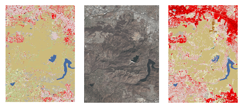
In this figure, provided by Dr. Mai Nguyen, supervised machine learning on high-resolution satellite imagery and land-cover maps are reclassified into higher resolution (spatial and temporal) data to enable better fire prediction. Emerging AI techniques offer a novel way to approach spatial heterogeneity and upgrading of data, enabling the ability to tailor combinations of available data for specific applications and model